

To quantify the tsunami risk for the Mediterranean coasts, an international team of researchers brought about the first earthquake-generated tsunami hazard model for the whole NEAM area (Northeast Atlantic Ocean, Mediterranean Sea, and connected seas up to the Black Sea).
This model, named NEAMTHM18 (NEAM Tsunami Hazard Model 2018), is the main product of the European Project TSUMAPS-NEAM, coordinated by the National Institute of Geophysics and Volcanology (INGV).
NEAMTHM18 is of particular interest for Italy, because it has been used as a basis for Civil Protection planning along the coasts of the country, also to manage public evacuation in response to a possible tsunami alert issued by the “SiAM”, the National Warning System for Tsunamis generated by seismic events to which the Tsunami Alert Center of INGV.
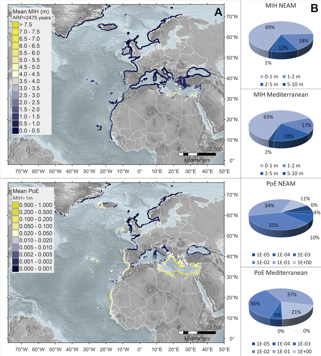
2,343 points of interest (POIs) distributed along the NEAM coastline at an average spacing of about 20 kilometers were considered in the definition and calculation of hazard. Starting from these points, maps of probability for different levels of maximum flood height (MIH) and hazard maps for different values of the average return period (ARP) can be made. Several examples, including the necessary documentation, can be found on the model website, accessible through a dedicated interactive tool.
? Link to press release (sito ingv.it)
? Link to the article (frontiersin.org)