


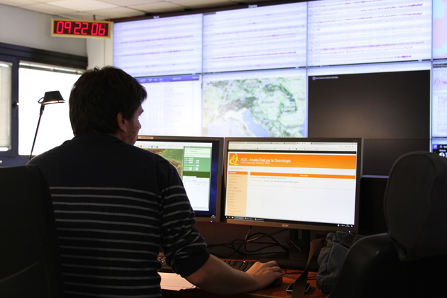
 The CAT-INGV station during a drill
 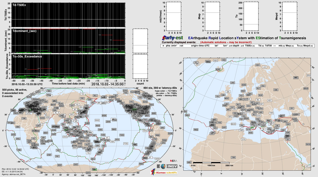 A screenshot of the program Early - Est
 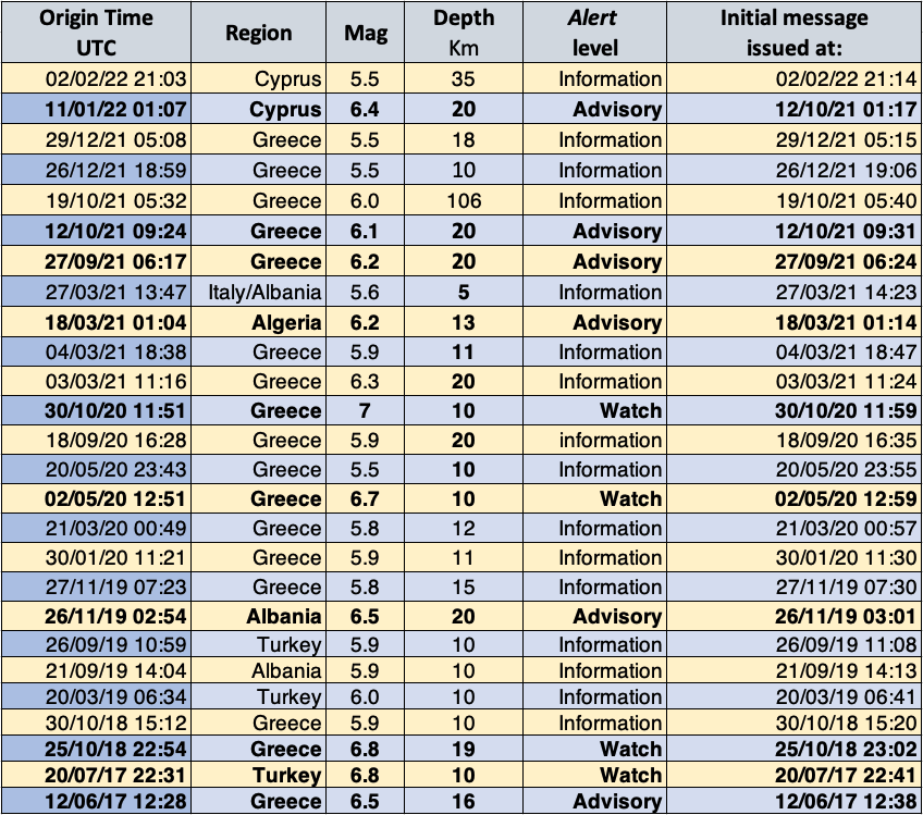 Table of events processed by the CAT-INGV and alert launch times (earthquake origin time, location, magnitude calculated by the USGS, magnitude calculated by the CAT, alert level and minutes elapsed from earthquake to alert launch)
From autumn 2014 at the Seismic Surveillance Room of the INGV in Rome, the Tsunami Alert Centre (CAT) monitors large earthquakes on a global scale, with particular attention to the Mediterranean Sea, as part of the activities of the ICG/NEAMTWS.
After the first two years of operation as a CTSP (Candidate Tsunami Service Provider), in summer 2016 the CAT applied to the ICG/NEAMTWS for accreditation as a TSP (Tsunami Service Provider) for the Mediterranean basin. Following the positive outcome of the verifications carried out by a special commission of the ICG/NEAMTWS, in September 2016 the CAT-INGV started to carry out the tsunami alert service for the entire Mediterranean basin, sending alert messages to other countries and centres in the Mediterranean region, which to date are Cyprus, Egypt, Germany, Israel, Lebanon and Spain.
The service is guaranteed by specialised personnel who alternate day and night, 365 days a year, at the CAT station.
The shift worker is assisted by an expert on call H24, who is contacted should an event occur above the threshold (M > 5.5) and in any region of the world.
The shifts are carried out by researchers, technologists and technicians who have followed training courses to integrate their knowledge as "seismic" shift workers, acquired over many years of seismic surveillance.
Contrary to seismic shifts, the CAT shifts include Early Warning messages in the case of major earthquakes at sea or in coastal regions. This is why the speed with which earthquake parameters are determined and verified (epicentre location, depth, magnitude) is very important. To obtain these parameters, the CAT shift workers use the software Early-Est, developed by Anthony Lomax and Alberto Michelini in the mid-2000s, and later improved.
Early-Est receives data from hundreds of seismic stations around the world and analyses them in real time in order to recognise any signals related to earthquakes. In case of a seismic event, it calculates a series of progressive localisations, determining the hypocentre coordinates and the magnitude.
The first estimate is made about 2 minutes after the earthquake, and the following ones, based on a greater number of data as the front of the seismic waves widens and reaches more distant areas, are recalculated every minute. From a study carried out on a large number of data on a global scale for the events of previous years, it was estimated that a good compromise between speed of calculation and accuracy was ensured by the location of Early-Est No 5, determined 5 minutes after the first estimate, thus about 7-8 minutes from the moment the earthquake originated. It is on this estimate that, unless otherwise decided due to particular circumstances, the first warning message which the CAT shift workers will send in the event of an alert is based.
As regards the two 2017 events of Lesvos and Kos-Bodrum, the first warning messages were issued by the CAT within ten minutes of the time the event originated.
The first alert message, which can be of the WATCH level (Red Alert) type, ADVISORY level (Orange Alert) type and INFORMATION (Green Alert) type contains the levels for the various countries concerned and a list of "Forecast Points" (FPs), indicating the expected level and estimated arrival time of the first tidal wave at each FP.
As regards the seismic event in Zakynthos on 25 October 2018, the first warning message was issued 8 minutes after the time of origin of the earthquake.
After the first alert is issued, shift workers begin to observe any changes in sea level. The first estimate of the alert levels is based, in fact, on a decision matrix which links these levels to the magnitude, the hypocentre depth and the distance from the coast. At the moment, these estimates do not take into account the type of earthquake, as in the first few minutes it is not possible to know precisely the characteristics of the fault which generated the earthquake. The CAT-INGV researchers are developing a probabilistic calculation system which takes into account the available knowledge to make more accurate and precise estimates.
We know that an earthquake with vertical fault movement (up-dip) will produce a deformation of the seabed which is much greater than a "transcendent" event, i.e. with a mainly horizontal movement on the fault.
In the event of a significant sea level anomaly observed in one (or more) of the tide gauges located near the epicentre, the shift worker will issue a message confirming tsunamis. In the on-going message, the sea level readings and the estimated arrival times of the various waves, both positive and negative, will be reported, i.e. the flooding and the withdrawal of the sea at the various tide gauge stations.
Unfortunately, to date the DART buoys, instruments placed on the high seas, designed for rapid detection, measurement and real-time reporting of tsunamis occurring in the open sea, which could confirm (or deny) the arrival of a tsunami before it reaches the tide gauge network along the coast, are not operational.