

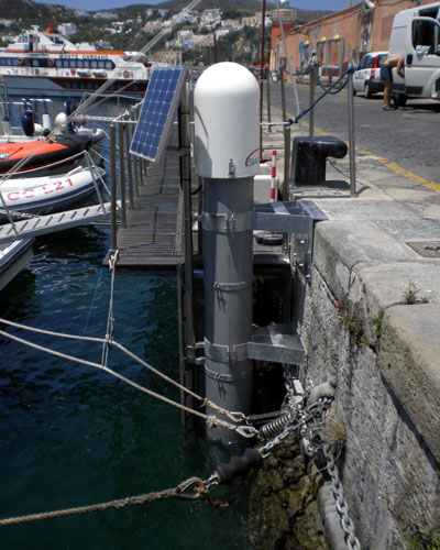
 The tide gauge station located in the port of Ponza
Current knowledge and technologies do not allow to know in real time and with sufficient certainty whether an earthquake has actually generated a tsunami or not. The analysis of the parameters of the earthquake (magnitude and seismic moment), which is carried out in the very first few minutes available to issue the alert, does not allow to accurately assess the extent of the vertical displacement of the fault blocks, and consequently of the volume of water displaced, making it impossible to assess instantly if there will be a tsunami and how large it will be.
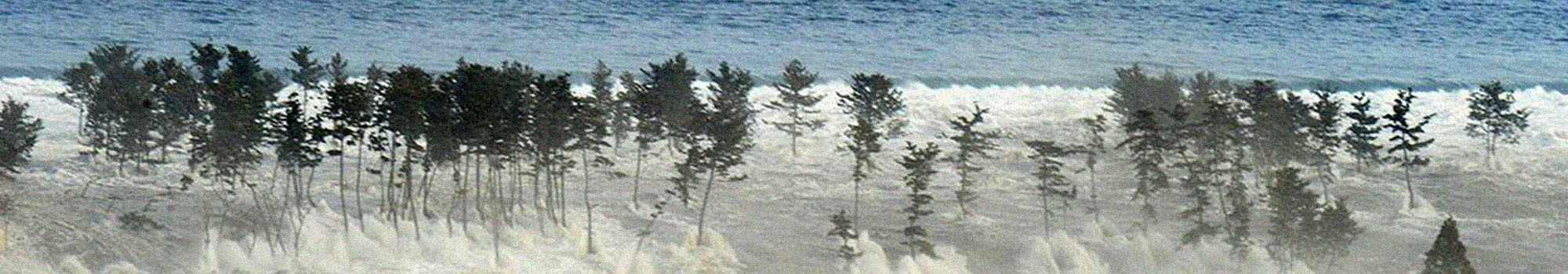
The only way to know is by monitoring the sea level, which consists in analysing in real time the data transmitted by the networks of tide gauges located along the coasts, which record all variations in water height, also filtering the effects due to wave motion and tides.
In the Mediterranean Sea the number of these instruments has increased considerably over the last ten to fifteen years, i.e. since the establishment of the ICG/NEAMTWS (Intergovernmental Coordination Group for the Tsunami Early Warning and Mitigation System in the North-eastern Atlantic, the Mediterranean and connected seas).
Unfortunately, despite the improvements, the number of tide gauges is still not sufficient to ensure a timely confirmation of the tsunami, especially in some areas such as the coasts of North Africa.
Moreover, in the Mediterranean, unlike in other oceanic areas, there are no networks of DART (Deep-ocean Assessment and Reporting of Tsunamis) buoys, located in the ocean or open sea, which would allow to detect and measure the passage of the wave before its arrival on the coast.
Monitoring the sea level is fundamental for the purposes of alerting and decision-making of the Civil Protection measures: when the CAT-INGV shift worker detects and locates an earthquake at sea or near the coast, of sufficient intensity to generate a tsunami, a specially developed program also provides an estimate of the theoretical arrival times of the possible wave at the tide gauges and various coastal locations.
These data are included in the alert message, issued immediately after having carried out the detection and estimate operations of the earthquake. The calculation of the wave arrival times takes into account not only the distance of the epicentre from the coast, but also the morphology of the seabed, which affects the wave’s propagation speed.
These operations also enable identifying the tide gauges closest to the area where the earthquake occurred, which can provide an initial confirmation that there was actually a tsunami and an actual estimate of how big it will be.
The accuracy and validity of these estimates depend to a large extent on the number of instruments available and on their placement along the coast: the denser the network, the shorter the time between detecting the earthquake and the consequent estimate of the extent of the event, and therefore of the timing of any confirmation or revocation of the alert.
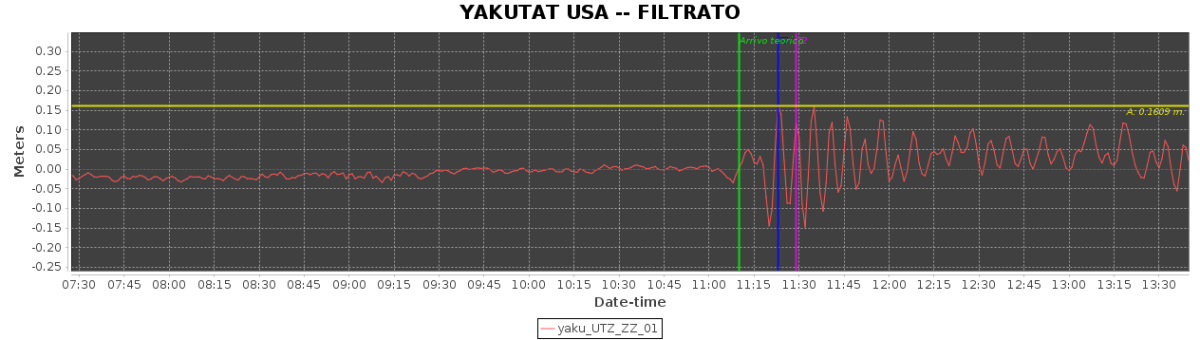 The signal from the Yakutat (Alaska) tide gauge station after the M 7.9 earthquake on 23 January 2018