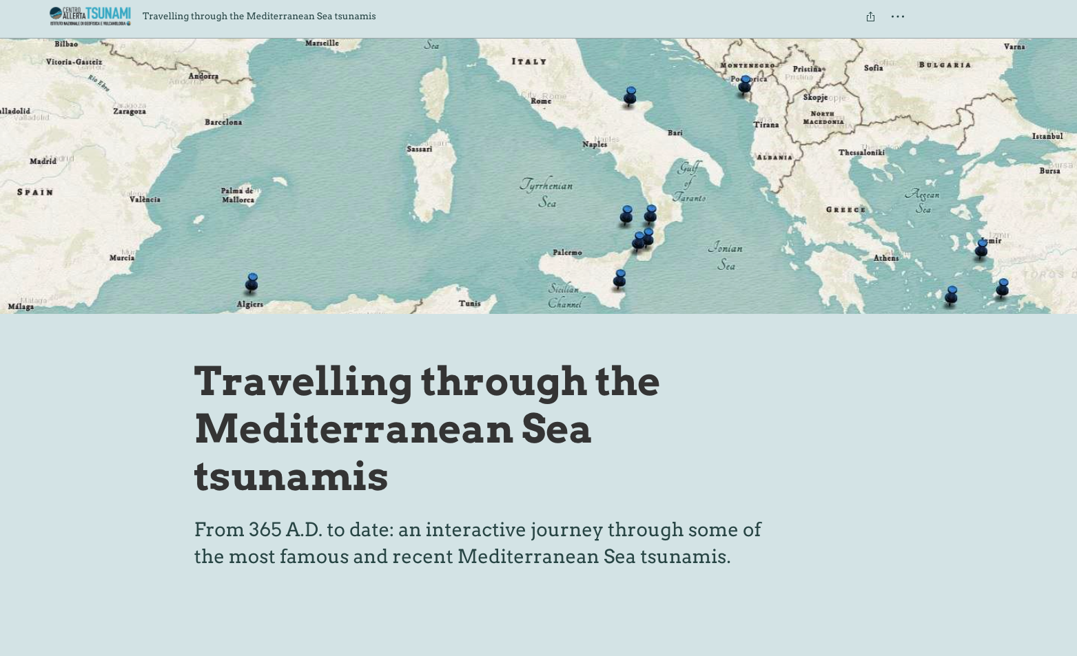

The storymaps section presents a new generation narrative tool based on the ArcGIS platform that allows users to interactively navigate through various types of content: text and hypertext content, images, videos and links.
Storymaps use the power of maps on which stories and paths are built and which users can navigate using shortcuts and immediately arrive at the information they are interested in.
The flexibility of interactive maps makes them a suitable tool for the creation and dissemination of scientific content such as that related to tsunamis.