

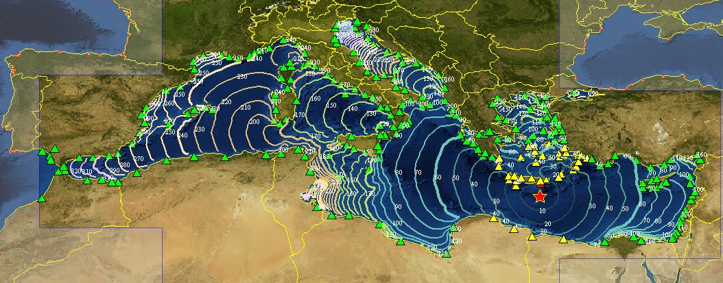
The figure shows the Isocrones ( theoretical lines that connect all the points reached by the tsunami wave in a given time interval from the origin and measured on the forecast points represented by the triangles that according to the color evoke the alert level, in this case: red in the stretches of Crete (GR) coast, yellow in the stretches of Greece, Turkey, Libya in the north-western Egyptian coast and green where no tidal varations are expected) and alert levels for the event in Greece on May 02, 2020.
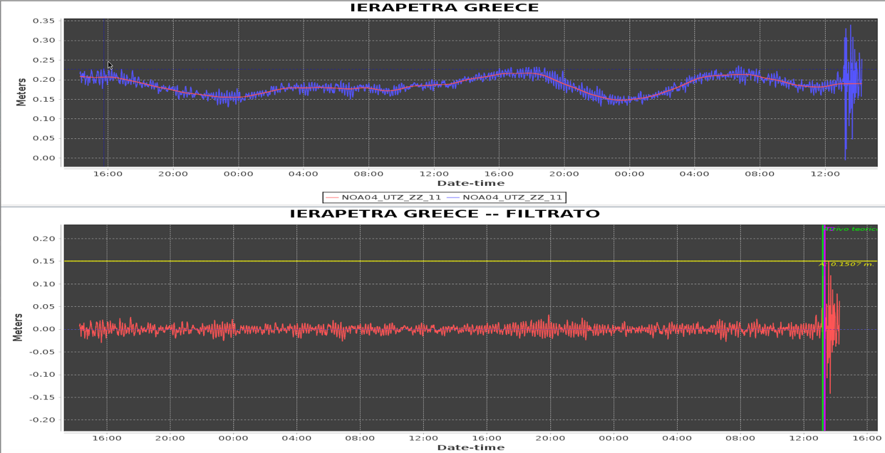
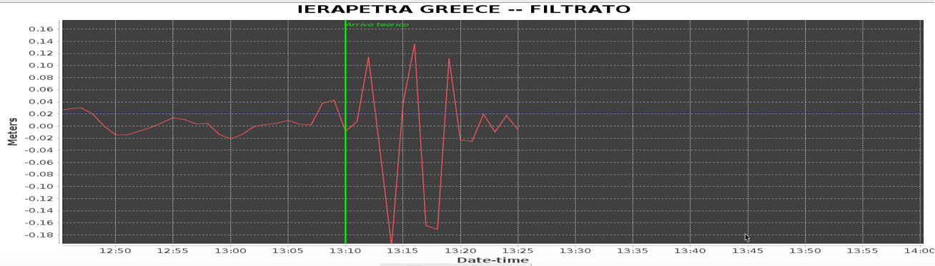
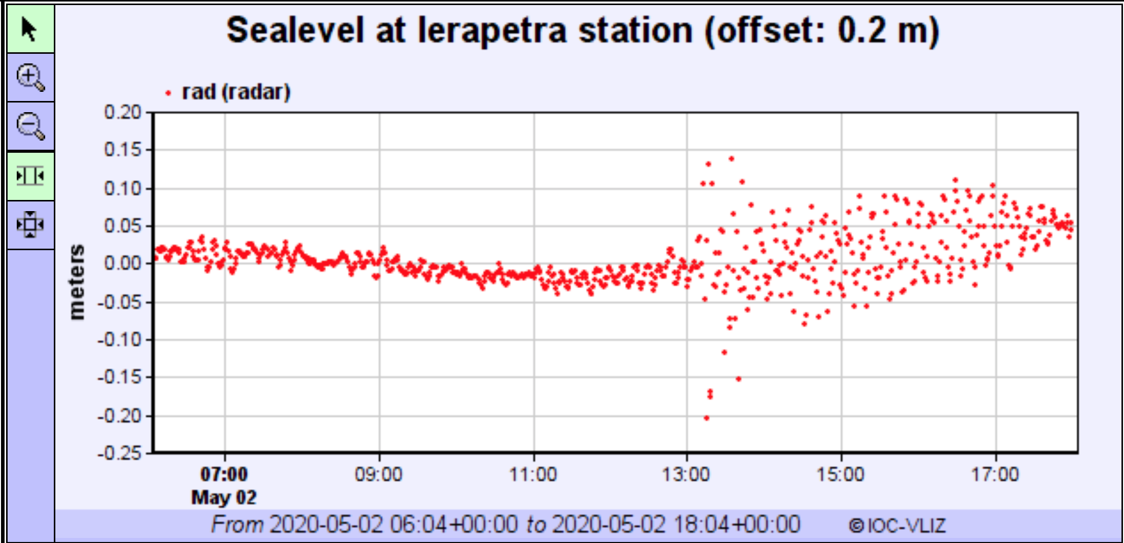
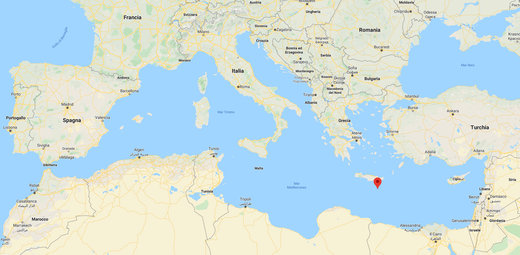
At 14:51:05 Italian time on May 02, 2020, an earthquake of magnitude Mwp 6.7 was located offshore Crete (GREECE), about 10 km deep.
✉️ First Watch alert message ( 1 Inglese | Italiano ?).
✉️ Second watch alert message | Ongoing ( 2 Inglese | Italiano ?).
✉️ Third watch alert message | Ongoing ( 3 Inglese | Italiano ? ).
✉️ Fourth end of alert message Watch ( 4 Inglese | Italiano ? )
The earthquake, in this case, generated a Red alert level - Watch (see decision matrix) on the southern coast of Crete Island, Orange alert level - Advisory on the coasts of Greece, Turkey and Libya, Green - Information in the whole Mediterranean basin. Communication flow included the sending by the system of 4 messages (first alert message, two confirmation messages and one closing message).