

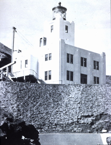
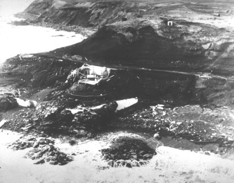
 On April 1, 1946, a large tsunami reached the coasts of the entire Pacific Ocean. Photo shows the Scotch Cap Lighthouse on Unimak Island, Alaska before and after the 1946 tsunami. Five people lost their lives in the lighthouse and waves reached about 35m run-up.
 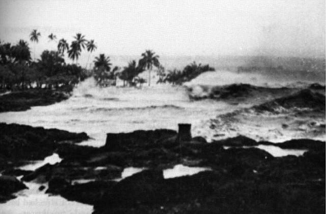 Tsunami waves in Hilo Bay, Hawaiian Islands
 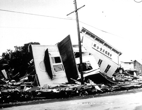 Ruins of the political party circle in Hilo, Hawaii.
On April 1, 1946, an 8.6 magnitude earthquake off the Aleutian Islands in Alaska generated a large tsunami that reached the Hawaiian Islands, California and the coasts of the entire Pacific Ocean within hours. Hilo Bay, on the east coast of Hawaii Island, where the town of Hilo, the main center of the island, is located, was reached by a wave of about 14 meters run-up that caused hundreds of casualties and severe and widespread damage.
The U.S. Coast Guard on Unimak Island (the largest and easternmost of the Aleutian Islands), issued a telegraphic warning, noting, "Strong earthquake felt. The building experienced a strong tremor for the duration of 30-40 seconds. Be careful." The U.S. Coast Guard ship Cedar was the first to notice the tsunami, which, impacting the coast, destroyed two sheds and the Scotch Cap Lighthouse at the southeastern end of Unimak Island. The warnings reached some coastal communities, which took precautions to evacuate coastal areas.
Some historical sources report that warnings issued by local authorities at great distances, where the earthquake was not felt, produced contrary effects by attracting inhabitants to the coast and nullifying risk mitigation efforts. Some authors claim that because the alert was issued on April 1, April Fool's Day, some people mistaken the warning and reports of a tsunami for a hoax.
Of course, that event led to the development of the first tsunami travel time maps in the Pacific Ocean, and later, the first warning system for earthquake-generated tsunamis, the most dangerous and the most frequent, was implemented.
In the following decades, warning systems were made for the entire Pacific Ocean, then more recently for the Indian Ocean (after the great tsunami of 2004), that of the Caribbean, and that of the NEAMTWS (North East Atlantic, Mediterranean and connected Seat Tsunami Warning System), in which the INGV Tsunami Alert Center operates.
Sources:
• Lander, J. F., Lockridge, P. A., & Kozuch, M. J. (1993). Tsunamis affecting the west coast of the United States, 1806-1992 (No. 29). US Department of Commerce, National Oceanic and Atmospheric Administration, National Environmental Satellite, Data, and Information Service, National Geophysical Data Center.
• Soloviev, S. L., & Kim, K. (Eds.). (1997). Catalog of tsunamis in the Pacific, 1969-1982. DIANE Publishing.
• Okal, E. A., & Hébert, H. (2007). Far-field simulation of the 1946 Aleutian tsunami. Geophysical Journal International, 169(3), 1229-1238. https://doi.org/10.1111/j.1365-246X.2007.03375.x