

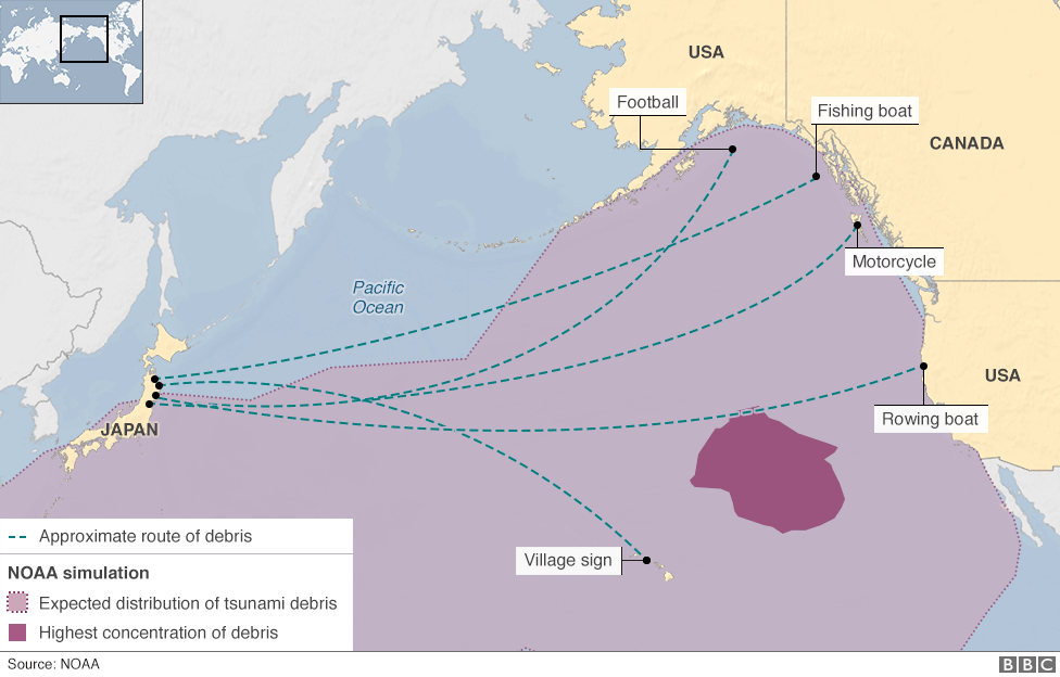
 Debris distribution map due to the 2011 Tohoku tsunami.
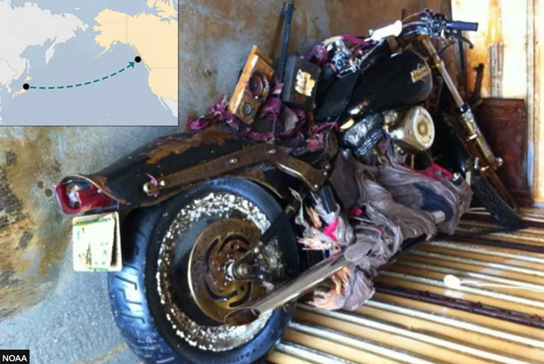
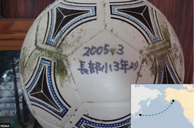
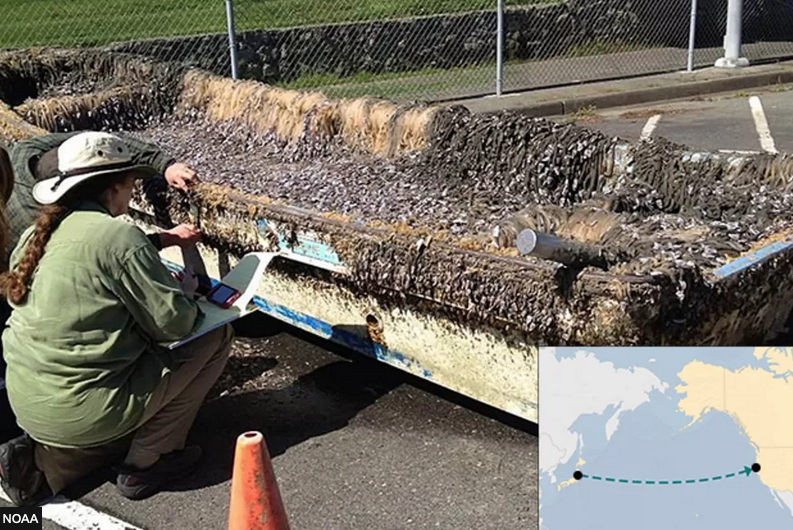 Pictures of some lost and found items along the coast of the Pacific Ocean.
Signed balloons, Japanese license plate motorcycles, Iwate Province house signs, and boats with information from Japanese boathouses. Just some of the objects and debris found along the Pacific Ocean shores dragged by the force of the tsunami that struck Japan and the coasts of nations facing the Pacific Ocean on March 11, 2011.
The earthquake that triggered the tsunami and caused run-up higher than 40 meters, had magnitude 9.1.
Coquimbo, Chile, over 16,000 km away, was reached by waves over two meters high; at Crescent City, California, 7500 km away, run-ups of over two and a half meters were recorded. Run-ups of up to 2 meters were also observed in Russia, South America, Hawaii, and the United States.
The disaster caused the death of nearly 16,000 people and the dispersal of a huge amount of debris into the sea. About 20 million tons of debris, according to Japanese government estimates, poured into the ocean waters.
The estimated debris flow map, on the left, shows the coastal areas where, due to the direction of the tsunami and facilitated by ocean currents, most of the objects were found. The purple-colored area between the Hawaiian Islands and the U.S. coastline identifies an area of high debris concentration.
Extraordinary stories of recovered objects are telling in the article published on the INGVterremoti website (link in italian).
More information and insights on the tsunami lost and found objects are narrated in the article published by BBC news and here.