

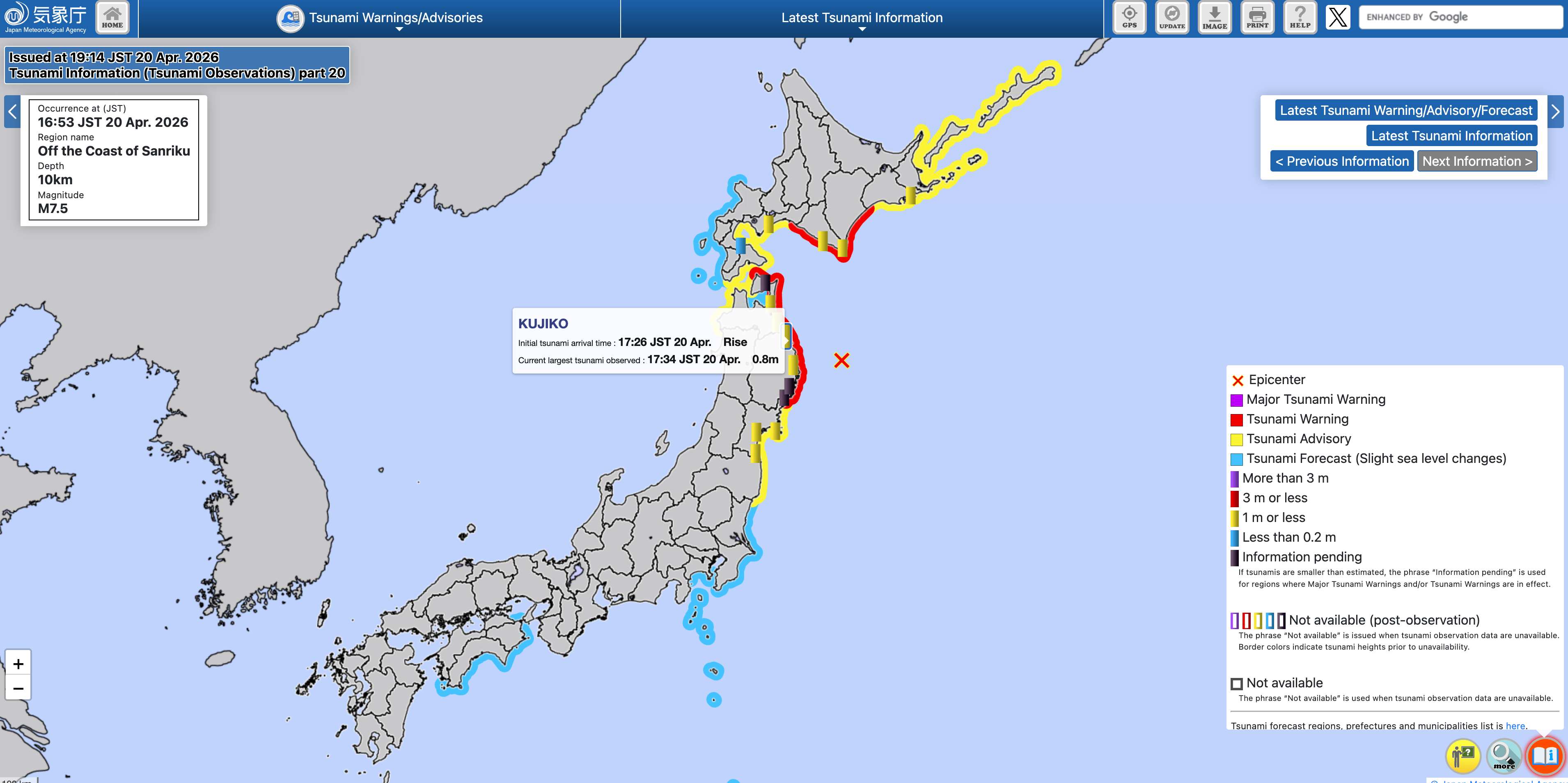
 Tratto di costa interessato dalle variazioni del livello del mare, contraddistinto per livello di allerta (fonte: JMA)
A 7.5-magnitude earthquake was recorded today, April 20, 2026, at 07:52 UTC (16:42 local time; 09:52 Italian time) off the northeast coast of Japan. The earthquake occurred at an estimated depth of approximately 30 km at coordinates Lat. 39.65, Lon. 143.13.
The Japan Meteorological Agency (external link) has issued a local tsunami warning due to expected sea level variations of up to 3 meters in height.
At 08:34 UTC, the JMA reported that the sea level measured at the Kujiko tide gauge is 80 cm above average. Several tide gauges located along the northeast coast of Japan—managed by the Japan Meteorological Agency’s local observation network—are detecting sea level anomalies in the range of 30 to 40 centimeters (e.g., Urakawa; Hachinoheko, etc.).
Unlike other countries and the alert levels used in Italy, Japan uses a different coding system for its alert levels:
a) a local Major tsunami warning (corresponding to our Watch alert level) for expected sea level changes exceeding 5 meters in height. This alert level was not issued in this situation.
b) a local Tsunami Warning (corresponding to our Watch alert level) for expected sea level changes of less than 3 meters in height in the prefectures adjacent to the earthquake’s epicenter (Iwate, Aomori, Hokkaido)
c) a local tsunami Advisory (corresponding to our Advisory alert level) for expected sea level changes of up to 1 meter in height, issued in the prefectures furthest from the earthquake’s epicenter (Fukushima, Miyagi, northern Hokkaido).